Calculate driving distance locally, without Google Maps API
Categories:
Calculate Driving Distance Locally Without Google Maps API
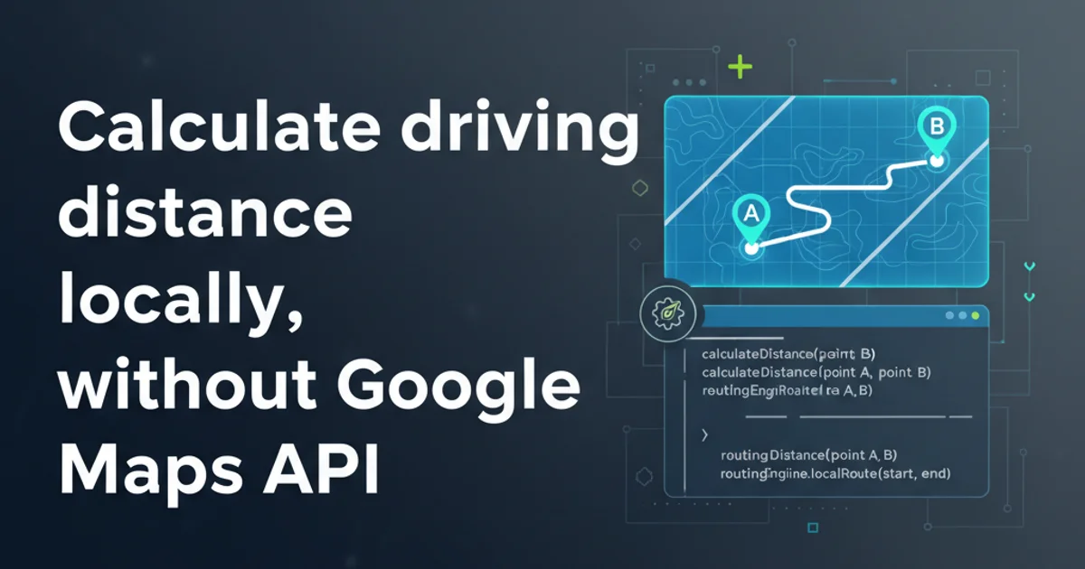
Explore methods to calculate driving distances and routes using open-source tools and algorithms, bypassing the need for proprietary APIs.
Calculating driving distances and routes is a common requirement for many applications, from logistics and ride-sharing to personal travel planning. While Google Maps API offers a robust solution, its usage comes with costs and rate limits. This article delves into alternative, local methods for computing driving distances, leveraging open-source data and algorithms. We'll cover the fundamental concepts, necessary tools, and practical implementation strategies to achieve this without relying on external commercial APIs.
Understanding the Core Components
To calculate driving distances locally, you need two primary components: a road network dataset and a routing algorithm. The road network provides the 'map' of streets, intersections, and their attributes (speed limits, one-way streets, etc.), while the routing algorithm finds the shortest or fastest path between two points on that network.
flowchart TD
    A[Start/End Coordinates] --> B{Geocoding (if needed)}
    B --> C[Road Network Data (OSM)]
    C --> D{Graph Representation}
    D --> E[Routing Algorithm (Dijkstra/A*)]
    E --> F[Path Calculation]
    F --> G[Distance/Time Output]
High-level process for local driving distance calculation
Data Sources: OpenStreetMap (OSM)
OpenStreetMap (OSM) is a collaborative project to create a free editable map of the world. It's an invaluable resource for local routing, providing detailed road network data. You can download OSM data extracts for specific regions or the entire world. These datasets typically come in .osm or .pbf formats and contain nodes (intersections, points of interest) and ways (roads, paths) with various tags describing their characteristics (e.g., highway=motorway, maxspeed=60).
osmosis or osmium-tool to filter and process large .pbf files, extracting only the relevant road network data for your specific area of interest. This significantly reduces memory footprint and processing time.Routing Algorithms: Dijkstra and A*
Once you have your road network data, you need an algorithm to find the optimal path. The most common algorithms for shortest path problems on graphs are Dijkstra's algorithm and the A* (A-star) algorithm.
- Dijkstra's Algorithm: Finds the shortest paths from a single source node to all other nodes in a graph with non-negative edge weights. It's guaranteed to find the shortest path but can be computationally intensive for very large graphs.
- A Algorithm*: An extension of Dijkstra's algorithm that uses a heuristic function to guide its search, making it more efficient for finding a path between two specific points. The heuristic estimates the cost from the current node to the target node, helping the algorithm prioritize promising paths.
import networkx as nx

def calculate_shortest_path(graph, start_node, end_node, weight='length'):
    """Calculates the shortest path using Dijkstra's algorithm."""
    try:
        path = nx.shortest_path(graph, source=start_node, target=end_node, weight=weight)
        path_length = nx.shortest_path_length(graph, source=start_node, target=end_node, weight=weight)
        return path, path_length
    except nx.NetworkXNoPath:
        return None, float('inf')

# Example usage (assuming 'G' is a pre-built graph from OSM data)
# G = build_graph_from_osm_data(...)
# start_node_id = get_nearest_node(G, start_lat, start_lon)
# end_node_id = get_nearest_node(G, end_lat, end_lon)
# path, distance = calculate_shortest_path(G, start_node_id, end_node_id)
# print(f"Shortest path: {path}")
# print(f"Total distance: {distance} meters")
Python example using NetworkX for Dijkstra's algorithm
Practical Implementation Steps
Implementing a local routing solution involves several steps, from data acquisition to path calculation.
1. Acquire OSM Data
Download .pbf files for your region from sources like Geofabrik (geofabrik.de) or BBBike (download.bbbike.org). These files contain raw OSM data.
2. Process OSM Data into a Graph
Use libraries like OSMnx (for Python) or GraphHopper (for Java) to parse the .pbf file and convert the road network into a graph data structure. Each road segment becomes an edge, and intersections become nodes. Edge weights can represent distance, travel time (based on speed limits), or other factors.
3. Geocode Start/End Points
If you have addresses, you'll need a local geocoding service (e.g., Nominatim, Photon) to convert them into latitude/longitude coordinates. If you already have coordinates, proceed to the next step.
4. Snap Coordinates to the Graph
Find the closest node or edge on your road network graph to your start and end latitude/longitude coordinates. This is crucial because your exact coordinates might not lie directly on a graph node.
5. Run Routing Algorithm
Apply Dijkstra's or A* algorithm on your graph between the snapped start and end nodes. The algorithm will return the sequence of nodes that form the shortest/fastest path.
6. Calculate Total Distance/Time
Sum the weights of the edges along the calculated path to get the total driving distance or estimated travel time.
Leveraging Open-Source Routing Engines
Instead of building a routing algorithm from scratch, you can use existing open-source routing engines. These projects have already solved many of the hard problems associated with graph processing and routing optimization.
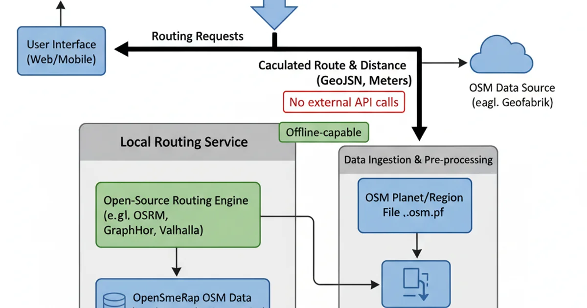
Application architecture using an open-source routing engine
OSRM (Open Source Routing Machine)
OSRM is a high-performance routing engine written in C++. It's designed for speed and can handle large road networks. You typically set up an OSRM server locally, process your OSM data, and then query it via an HTTP API.
# Example OSRM workflow
osrm-extract data.osm.pbf -p profile.lua
osrm-partition data.osrm
osrm-customize data.osrm
osrm-routed data.osrm

# Then query via HTTP (e.g., http://localhost:5000/route/v1/driving/lon1,lat1;lon2,lat2)
GraphHopper
GraphHopper is a fast and flexible routing engine written in Java. It also uses OSM data and provides a powerful API. It's known for its ease of use and good documentation.
// Example GraphHopper usage (conceptual Java code)
GraphHopper hopper = new GraphHopperOSM().for \(new GHRequest\("start_lat,start_lon", "end_lat,end_lon"\)\);
hopper.importOrLoad();
Response rsp = hopper.route(req);
// Process response for path and distance
Valhalla
Valhalla is another open-source routing engine, written in C++, with a focus on multimodal routing (driving, cycling, walking, public transport). It's highly configurable and offers a robust set of features.
# Valhalla setup involves building tiles from OSM data
# Then querying its HTTP API
# Example query (conceptual JSON payload)
# curl -X POST -d '{"locations":[{"lat":40.7128,"lon":-74.0060},{"lat":34.0522,"lon":-118.2437}],"costing":"auto"}' http://localhost:8002/route